
Salem ZIP Code Coverage
Salem’s core street-delivery pattern is best read as a set of postal service areas, not as a map of city neighborhoods. The coverage below draws from local address examples and agency addresses documented for Salem. Each entry still needs an address-level check because a route can cross city and county lines. The Salem ZIP code directory is most useful when it identifies the next verification step rather than assigning a resident or parcel to a broad area.
| ZIP | Areas Covered | Post Office | Notes |
|---|---|---|---|
| 97301 | Central Salem and the city/county core address area | Salem postal service | Government addresses may use nearby government forms; verify the exact delivery address. |
| 97302 | South and central Salem delivery area | Salem postal service | Postal area does not mark the city limit. |
| 97303 | North Salem delivery area | Salem postal service | Use as delivery geography, not a neighborhood boundary. |
| 97304 | West Salem, including Salem city territory in Polk County | Salem postal service | A Salem address here can require Polk County records. |
| 97305 | Northeast and east Salem delivery area | Salem postal service | City and postal boundaries can differ at the precise point. |
| 97306 | South and southeast Salem delivery area | Salem postal service | Do not infer Assessor jurisdiction from the code alone. |
| 97317 | East and southeast fringe, plus nearby unincorporated or adjacent addresses | Salem postal service | Documented in City PAC addresses; it extends beyond a simple city-neighborhood label. |
The list does not convert a postal route into a list of people. It separates the central, north, south, west, east, and fringe patterns so a full address can be sent to the correct postal, municipal, and county checks.
Salem Postal Address Check
The authoritative answer for a particular mailing address comes from the USPS postal lookup, not from a city name, a nearby address, or a generalized map. Enter the street address with city and state when an address-level result is needed. USPS assigns these codes for delivery operations, while the City limits locator decides whether a point is within municipal boundaries and the County Assessor or GIS resolves parcel jurisdiction.
Those authorities can all be correct at once while answering different questions. A Salem postal city may reach beyond the City, and a City address can require a county route that is not obvious from the mailing line. Keep the postal answer alongside the local-jurisdiction answer instead of letting one replace the other.
West Salem ZIP County Split
West Salem is the clearest local reason to verify more than a code. The 97304 delivery area includes Salem territory across the river in Polk County. A Marion County parcel result cannot be assumed simply because the mailing city is Salem. Begin with the City limits locator, then identify the county before selecting an Assessor, recording, court, or elections route.
This records geography is useful for family property research and civic questions alike. It prevents a postal label from sending a search into the wrong county office or from turning a broad delivery area into a claim about city jurisdiction.
Salem Special Service ZIPs
Codes 97309, 97310, 97311, 97312, and 97314 appear in the Salem postal-system network, but the research does not establish them as ordinary street-delivery areas. Verify the recipient and complete address in USPS Lookup every time. They may represent a special or system function, and a code by itself does not reveal the correct delivery classification.
The Salem sorting-and-delivery-center publication is useful operational context because it lists these special codes alongside several core service codes. It does not draw a municipal boundary or supply a street-level map. The ZIP code directory therefore keeps special codes distinct from the core delivery pattern.
Why Salem ZIP 97392 Differs
ZIP 97392 is a Turner-area code handled in the Salem service network. That operational overlap does not make it a Salem city address or a substitute for one. Check the recipient and full address through USPS, then use the City locator and county sources if the question concerns municipal or parcel jurisdiction.
Separating the Turner-area code from Salem’s core pattern avoids a common shortcut: service-network coverage is broader than the city it serves.
Search Salem by Postal Area
A code can narrow the place to research, but it should not produce a ZIP-to-resident conclusion. Start with one complete address and identify the task: postal delivery, municipal location, parcel context, a permit record, or a credential search. The available official tools do not offer the same kind of code filter.
- Verify the mailing route. Run the complete address through USPS Lookup and preserve the returned postal information with the address.
- Check the City boundary. Use the City limits locator to decide whether the point is in Salem, then identify Marion or Polk County before choosing a county system.
- Use the tool that exposes the needed field. The Medical Board supports a five-digit code with distance in its specialty search. A parcel or permit task should use the address rather than an assumed code filter.
- Keep the result narrow. Compare source date, street suffix, and jurisdiction. Once a location is narrowed to a street, the Salem street directory has the address-level record trail.
The correct outcome may be a postal confirmation rather than a personal record. That is still useful because it keeps the next request or record search in the right jurisdiction.
Salem Postal Search Fields
The Oregon Medical Board is the documented local portal with a code-aware search path. It is a credential verification system, not a residential roll. Its search options should be used only to check regulated status and the location details the Board displays.
| Search route | Primary input | Verified location option | What the result concerns |
|---|---|---|---|
| Name | Last name and first name | Not required for the name route | A Board credential record |
| Credential number | Credential number | Not required for that route | A specific Board credential |
| Specialty | Specialty | City or five-digit ZIP plus distance | Credential results matching the chosen specialty and location criteria |
Open the Oregon Medical Board search when a specialty and location filter fit the question.
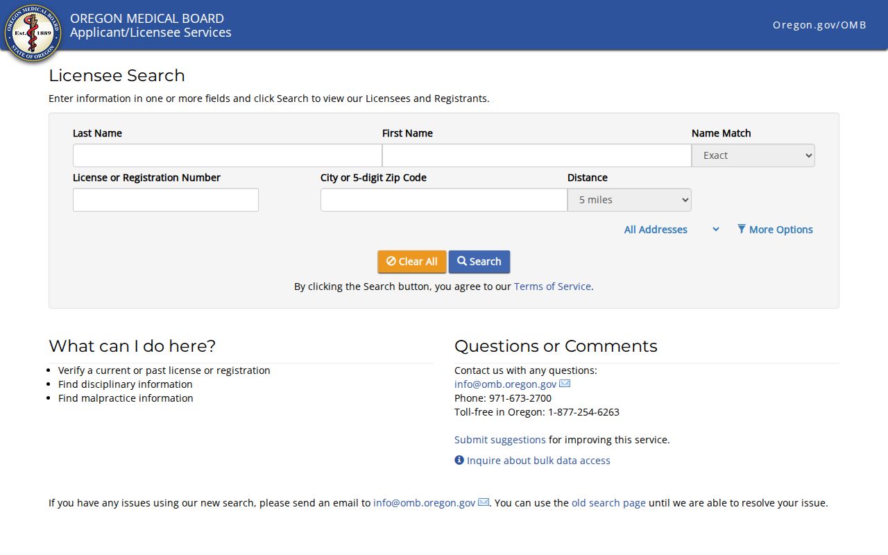
A city or code filter can focus a credential inquiry, but a practice location does not establish where a credential holder lives.
Salem ZIP Parcel Permit Limits
Marion County’s Assessor describes property information that includes ownership, mailing, location address, tax lot, district, and assessment detail. Its reviewed live fields were gated, so no ZIP-only Assessor filter is claimed. The County maps gateway is useful for parcel context, streets, and available layers, but the mapper is not a legal survey. For a property question, start with the actual address and the correct county.
Review the Marion County Maps and GIS gateway when a parcel or jurisdiction layer is needed.
Salem PAC guidance supports searching by address, permit number, or other relevant information, but it does not establish a public ZIP-only mode. A voter-search entry also displayed a CAPTCHA during research, with no verified code field available to claim.
Salem recognizes 17 Neighborhood Associations and provides an address-based finder for civic context such as notices, meetings, and local land-use discussion. An association result is separate from a postal route, City limit, or parcel line and should never be used to infer an individual connection.
Salem ZIP Code Boundaries
Postal codes, Census ZCTAs, city limits, and parcels are four different geographies. ZCTAs are generalized Census statistical areas, not USPS ZIP Codes, and not every code has a corresponding ZCTA. A City locator answers the municipal question. County Assessor and GIS systems address parcel jurisdiction. USPS is the final postal authority for a specific address. The same address can require all three checks.
Read the Census explanation of ZCTAs before using a statistical boundary as a postal reference.
The Census distinction is a reminder to verify the delivery code through USPS rather than treating a map label as a mailing result.
- ZIP vs. ZIP+4
- A five-digit ZIP identifies a broad delivery area. ZIP+4 adds a more specific delivery segment within that system.
- PO-box ZIP
- A code used for post-office box delivery. It should not be treated as a street-delivery area without USPS confirmation.
- Unique ZIP
- A code assigned for a particular organization or delivery purpose rather than a general neighborhood. Confirm the recipient and address.
- Carrier route
- A delivery sequence used by postal operations. It is not a city boundary, parcel line, or proof about a resident.
Historical Salem ZIP Address Context
Older address evidence should keep the postal and street information printed in the original source. Do not backfill a modern code onto a historic directory, deed, or map unless that source uses it. Salem’s street-name changes can also separate an older address from a modern lookup. The documented 2022 renaming of Salem Parkway to Dr. Martin Luther King Jr. Parkway is one reason to compare historical and current street names. It is a local example, not evidence of a citywide renumbering pattern.
For a family-history or property trail, preserve the source year, spelling, directional suffix, and original address form. A modern postal confirmation can help locate a present address, but it does not rewrite what an older record said.