
Salem Street Search Sequence
Begin the Salem street directory process with a complete address: number, street name, directional suffix, unit or space detail where used, city, state, and ZIP Code. Salem records regularly use directionals such as NE and SE. Leaving one out can point to another street or prevent a useful match. Preserve road, street, and avenue wording too, along with an older street form when a historical record supplies one.
Move from location to record purpose. First confirm the point and its county, then identify the parcel, use a map only for context, carry the legal description to recorded documents, and compare dated directories for historical listings. That sequence avoids treating one search result as proof of every fact about an address.
- Use the Salem city-limits locator to check the point before selecting a county record path.
- For a Marion County address, open the Marion County Assessor property search and retain the account or tax-lot reference when available.
- Compare the parcel with Marion County Maps or the County Open Data route to understand street and parcel context.
- Use the parcel’s legal description in the Clerk’s recorded-document research rather than relying only on the street address.
- For an older listing, compare the address with a dated reverse directory or name directory and retain the publication year.
Salem Address County Check
Salem crosses the Willamette River into both Marion and Polk counties. A postal city name does not choose the county custodian, and a ZIP Code does not settle the question either. The City locator is the first check because it identifies a municipal point, while the county Assessor and Clerk are the sources for the parcel and recording path that applies after that check.
West Salem is the practical reason to pause here. A location can be within Salem city geography while its county records belong in Polk County. For a Marion address, the County Assessor can link the street location to an account and tax lot. If the locator points elsewhere, do not force the address into Marion sources merely because Salem appears in the mailing line.
Note: Retain the exact directional suffix and county conclusion with every search note, especially when later documents use an older street form.
Salem Assessor Address Fields
The Assessor’s public property information is the current parcel layer for a Marion County street directory search. Its official description identifies property description, ownership, tax-lot, district, and assessment information, and tells users to review ownership, mailing, and location addresses. The live interface was gated or dynamic during review, so no unverified search-box labels are assumed here.
| Location address | Connects the account to the physical parcel and should retain its exact directional form. |
|---|---|
| Ownership and mailing | Property-record fields that can start a document search, but neither establishes current presence at the address. |
| Tax lot | Links the account to parcel context and helps carry the research into map and recorded-document work. |
| District and assessment | Describe the assessment record, not a household listing or a legal boundary. |
The County says its online information refreshes every 24 hours. Record the retrieval date and account identifier. A changed mailing address or owner name is a reason to check the underlying record date, not a reason to infer occupancy.
Salem Parcel Map Context
County GIS is useful for placing an address among streets, parcel shapes, nearby roads, and available map layers. The Marion County Open Data gateway and county map tools provide a visual cross-check after the Assessor account is identified. This is especially useful where a street is near a jurisdiction line or where nearby parcels need to be distinguished.
A map is not a survey. Marion County cautions that Internet Mapper maps lack legal-survey quality. Use GIS to compare street and parcel context, then use a recorded legal description or a qualified survey source for a boundary conclusion. The map also cannot identify a household or prove that a person tied to another record currently lives at the property.
- Parcel
- A defined tract represented in assessment and mapping systems, often associated with an account or tax lot.
- Situs address
- The physical location address assigned to a property. It can differ from the owner’s mailing address.
- Plat
- A recorded map that can identify subdivision lots, blocks, streets, or a partition reference.
- Criss-cross directory
- The address-order portion of a later directory, used to find a dated listing from a street address.
Salem Legal Description Trail
A street address starts the search, but the legal description carries it into the recording system. Marion County recording guidance explains that the description may use a subdivision lot and block, metes and bounds, section-township-range, a partition-plat parcel, or a prior book and page reference. A tax lot or street line alone does not replace that wording.
Copy the description and compare it across documents before deciding they concern the same property. This matters when a street name has changed, a subdivision has a similar name, or a record predates the current address. The description, instrument type, parties, and recording reference should agree before a deed is added to an address history.
Salem Recorded Document Ranges
The Marion County Clerk separates two related record paths: recorded documents from 1974 to the present and historic deeds from 1855 to 1976. Those date ranges overlap, but they are not interchangeable systems and may not supply the same index fields or images. Cite the route actually used and keep the recorded date distinct from an event date described in the document.
The Marion County Clerk Licensing and Recording office is the official starting point for the document route.
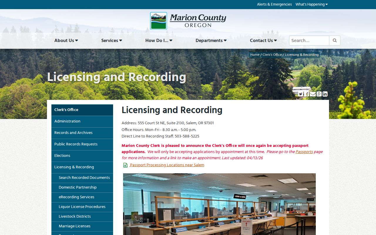
The Clerk’s office is at 555 Court Street NE, Suite 2130. Public in-office document searching is free; the County posts copy charges of 25 cents per page and search and certification charges of $3.75 each. A downloaded image is not a certified copy, so request certification from the Clerk when that status is needed.
Salem Street Record Coverage
Several Salem sources are keyed to an address, but they answer different questions. The table keeps the practical boundaries visible. It is safer to connect records through a parcel reference, legal description, and date than to turn a street name into a general roster.
| Address source | Custodian | Useful record detail | Important limit |
|---|---|---|---|
| Property account | Marion County Assessor | Property description, ownership, mailing, location, tax-lot, district, and assessment fields | Refreshes every 24 hours and does not prove current presence |
| Parcel map | Marion County Maps and GIS | Street, parcel, tax-lot, and map-layer context | Not legal-survey quality |
| Recorded documents | Marion County Clerk | Document and legal-description trail | 1974-present route differs from 1855-1976 historic deeds |
| Permit and planning record | Salem PAC | Administrative work, status, and inspection context | Online history begins July 1, 2005 |
| Historic directory | Library and heritage collections | Dated address or name listing | Address-first reverse indexes begin in 1932 |
Oregon’s individual voter search has a CAPTCHA and was not reviewed as a completed query. It is an official verification path with statutory and confidentiality limits, not a street-by-street roster. Protected addresses and restricted records must remain unavailable.
Matching sources requires restraint. A current Assessor account may identify the parcel tied to a street number, while an older directory may preserve a historical listing at that address. A Clerk document may show a recorded transfer without identifying a resident, and PAC may place administrative work at the property without linking any named party to the household. Keep each item under its source type and date, then compare the legal description before treating records as part of one address trail.
Salem Permit Dates by Address
The City’s permit and license search guidance directs address research to the Permit Application Center. Online material reaches back to July 1, 2005 and can cover structural, electrical, mechanical, plumbing, development, land-use, parking, and license material. Depending on the record, it may show a work description, status, inspection timing or result, and applicant or contractor details.
That is an administrative history, not a resident list. A permit can date activity at a location but does not prove that the applicant, contractor, owner, or any named party lived there. Earlier applications, plans, permits, and forms are City public records rather than records promised in the portal, so a focused request should identify the address, period, and material sought.
Salem Streets in Directories
For historic street directory work, the publication year controls the method. Salem’s historic-property guidance says reverse indexes allow address-to-name research beginning in 1932. Before that point, begin with a person’s name and search forward through the available name directories. Preserve the spelling, abbreviation, title, year, and page rather than converting an old entry into a current identity claim.
Salem Public Library links researchers to historical newspapers, maps, genealogy resources, and Sanborn maps, while the Willamette Heritage Center preserves a digitized 1871 Salem directory and a 1892 map. The public record of holdings confirms selected directory years, not a complete uninterrupted series. Ask the library or heritage collection about the desired year instead of assuming a missing volume exists.
Note: A directory listing establishes what was printed for that publication year; compare it with deeds, maps, and legal descriptions before linking it to a parcel.
Salem Parkway Name Change
Street-name history can break an otherwise careful search. Salem publicly documented the 2022 renaming of Salem Parkway to Dr. Martin Luther King Jr. Parkway. When a deed, map, directory, or newspaper uses the former name, retain that form beside the current name and note the record date.
This documented change supports an old-and-new name cross-check for that roadway only. It does not establish a citywide renumbering pattern or show that every similar street has a former name. Directional suffixes should remain unchanged in every citation and search note.
Salem Street Civic Context
A street also has a civic geography. Salem recognizes 17 neighborhood associations, and the City’s address-based association finder can connect a location with relevant notices, agendas, meetings, and planning discussion. This can add useful context to a PAC planning record or a local-history question.
Association results are not title evidence and do not identify a property owner, household, or member. They describe the civic area associated with an address. Keep that boundary clear when using association materials alongside property documents.
Salem Street Research Limits
Address records have different evidentiary weight. An Assessor ownership or mailing field is not proof of current presence, a GIS line is not a survey, a PAC entry is not proof of later involvement, and a directory listing is tied to its publication date. The Oregon Address Confidentiality Program, protected voter information, sealed records, and other legal limits are boundaries, not gaps to reconstruct from other sources.
For a records request, identify the agency, record type, finite date range, address, and parcel or document reference where known. Oregon’s public-record process does not require an agency to create a new record for a broad address question. A narrow request is more likely to reach the right custodian and makes the source boundary clear from the start.
Lawful use. Use Salem street records for personal research, family history, and civic understanding. Do not use an address or record trail to stalk, harass, intimidate, or harm anyone.